Town of Tisbury Master Plan (DRAFT) August 5, 2004
Upper State Road Suggested Planning Alternatives
June 30, 2004
Local Street System
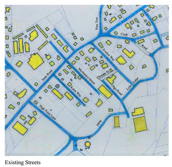
Figure 9 Existing
neighborhood streets off State Road
Today, the streets to the south of State Road form a partial grid of
streets that are largely disconnected from each other. If they were linked to each other,
vehicles and people could circulate within the area without exiting out on to State Road.
***
Proposed neighborhood street Grid
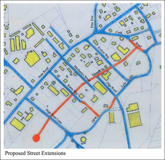
Figure 10 Proposed
neighborhood street Grid
An extension of Eleanor Way (a street parallel to State Road) to and past High Point
Lane, along with extensions of Kate’s Way and Mechanic’s Way to the DPW road,
creates a grid of neighborhood streets that interconnect in a way that allows circulation
throughout the neighborhood without exiting on to State Road. It also allows properties to
be unfilled with mixed uses and higher density housing that take advantage of their
proximity to transit, shops and services.
********************************************************************