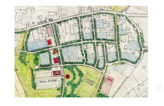
Figure 12 Blue shaded areas indicate potential residential development sites.
Town of Tisbury Master Plan (DRAFT) August 5, 2004
Housing Opportunities
Figure 12 Blue
shaded areas indicate potential residential development sites.
More than seven acres of marginal and vacant land exists in the area
bounded by
With year-round commercial services within walking distance of this
area as well as schools, transit, parks and recreation facilities, it is a very attractive
location for new housing.
We are recommending that the zoning be revised to allow residential units to be built more compactly than is presently allowed (perhaps 10-12 units per acre instead of the usual 4).
********************************************************************